Adding/Editing Stations
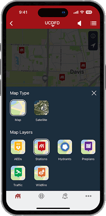
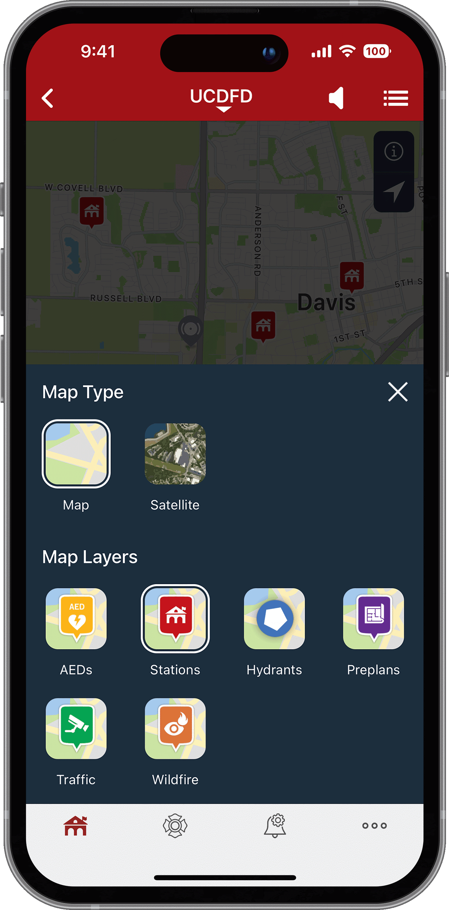
Agencies can define a Station Map Layer for display within the PulsePoint Respond app. Stations are an optional map layer accessible to all users. Stations are also visible from the agency profile page.


Station Map Layer
Station Definition
From within PulsePoint Central, Stations are defined in Agency Admin > Stations. Adding or modifying stations requires Administrator rights.
Use the + New Station button to add a station.
Use the Search Place/Address field to find the station using its address or name, such as San Ramon Valley Fire Station 31. Then, select the location from the presented options.
Enter the desired station name.
Enter assigned apparatus and other station details as desired.
Drag the map pin to locate the station more precisely if necessary.
Use the + Add Photo button to include one or more station images (optional).
Once submitted, changes can made by tapping the edit (pencil) icon. Remove a station using the delete (trash) icon.
Station Display

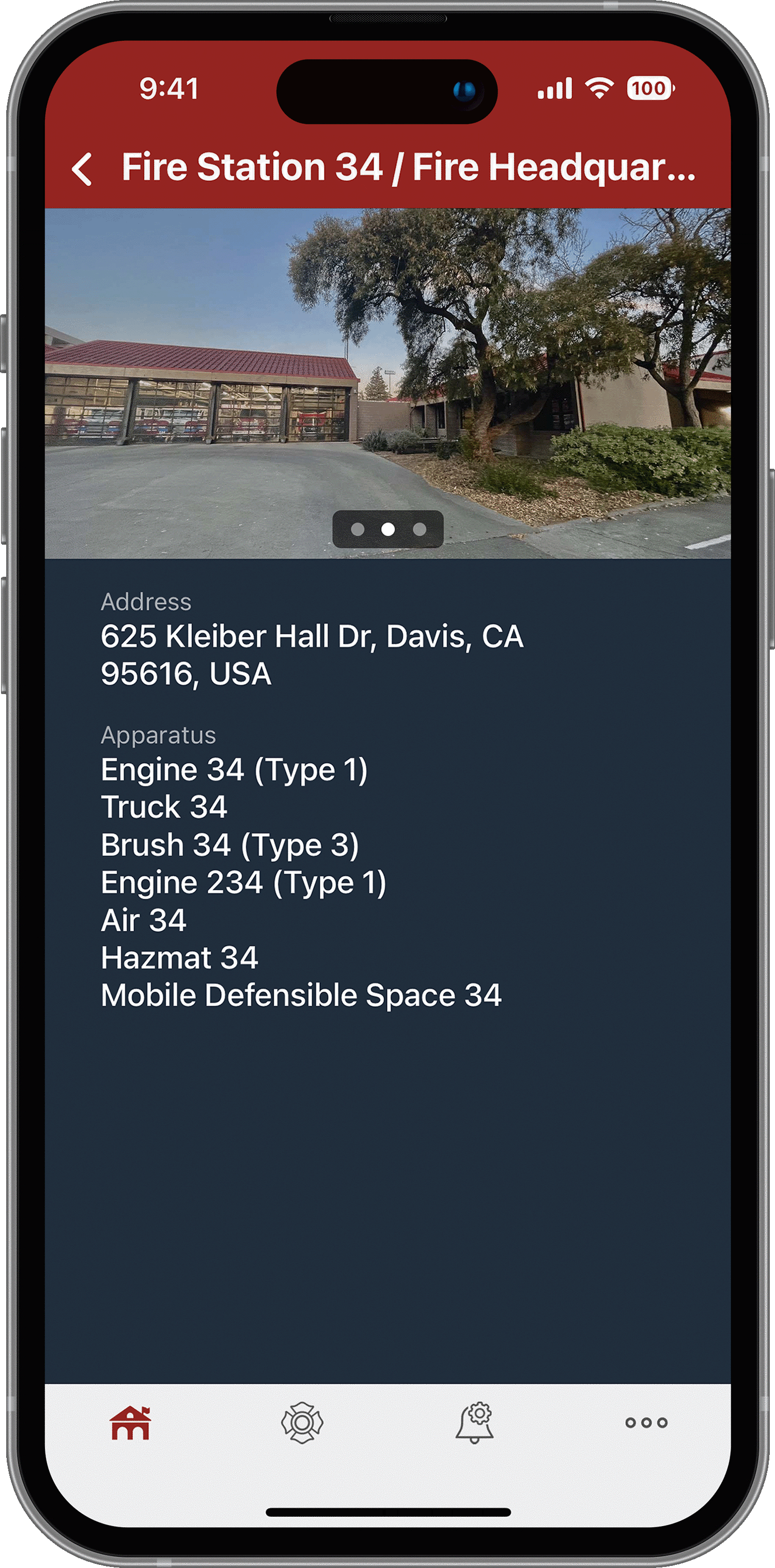
PUBLIC-FACING FACILITY LOCATIONS AND DETAILS
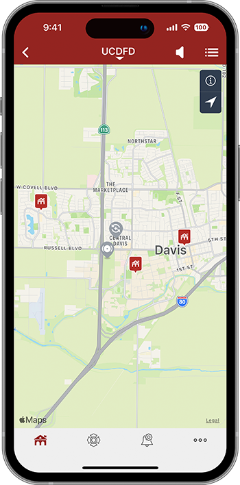
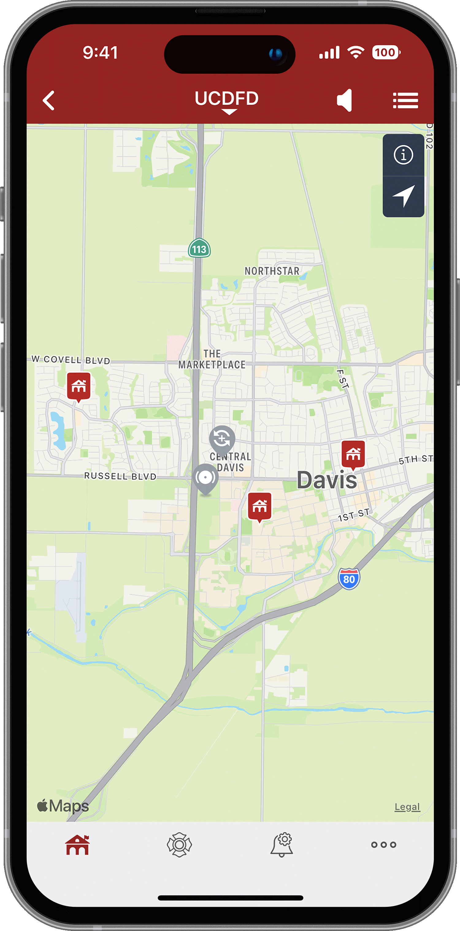
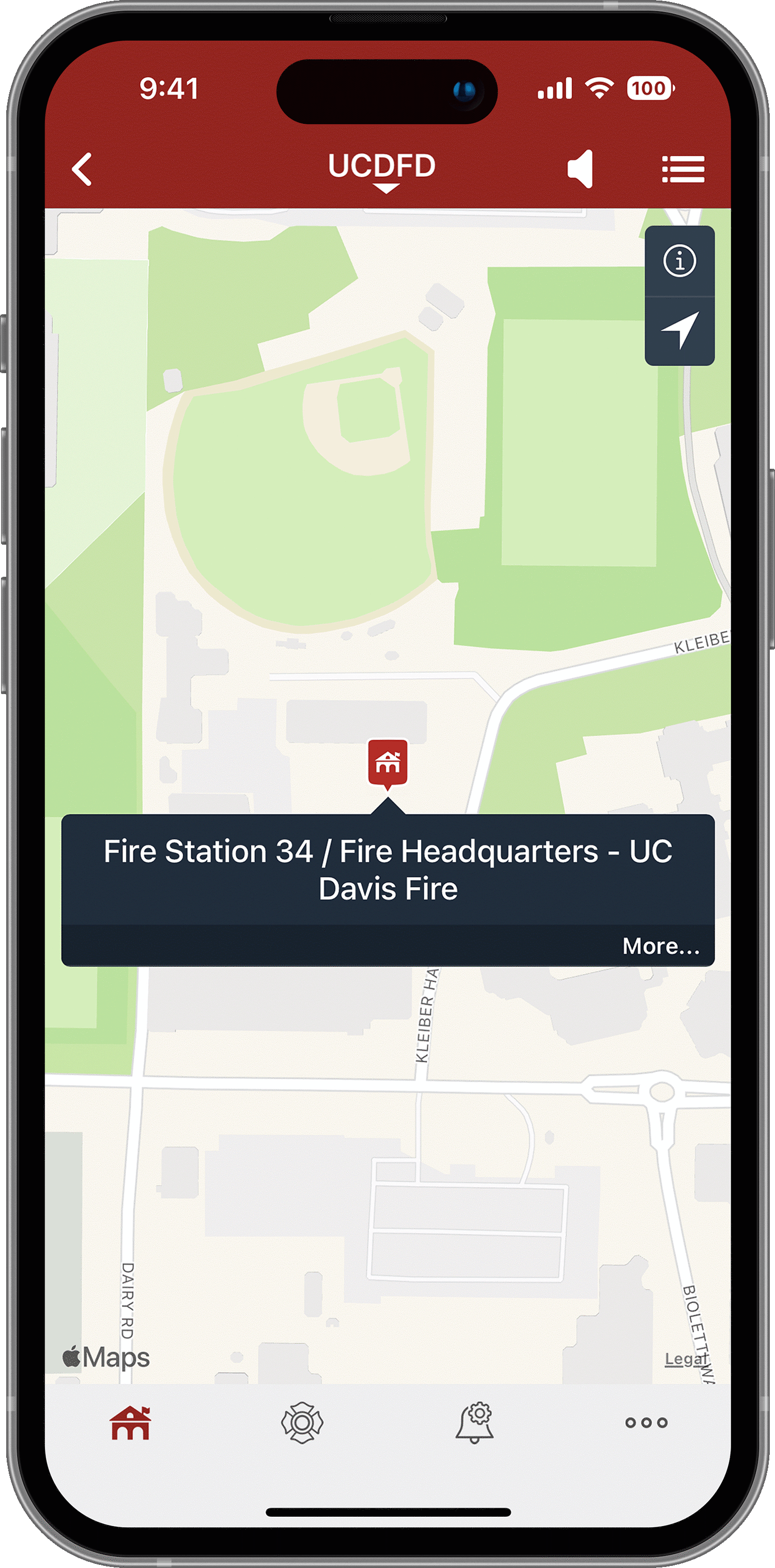
Station icons are displayed on the incident map and can be toggled on or off by the app user. Station locations are also accessible from the agency profile page.
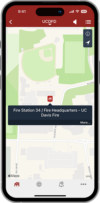
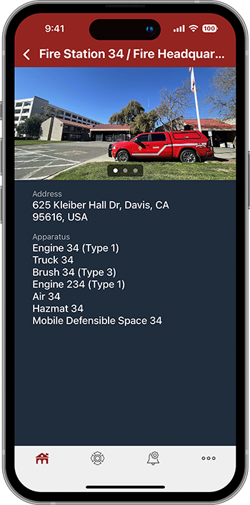
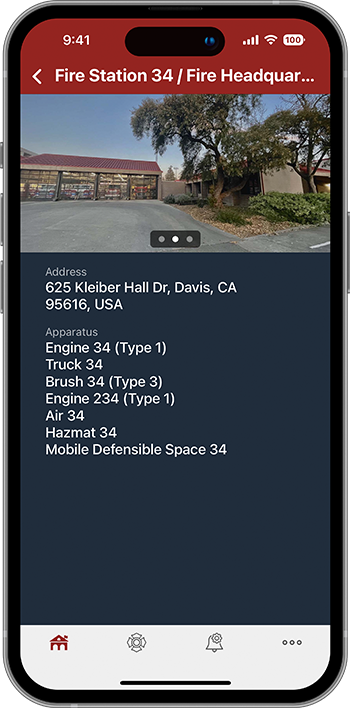
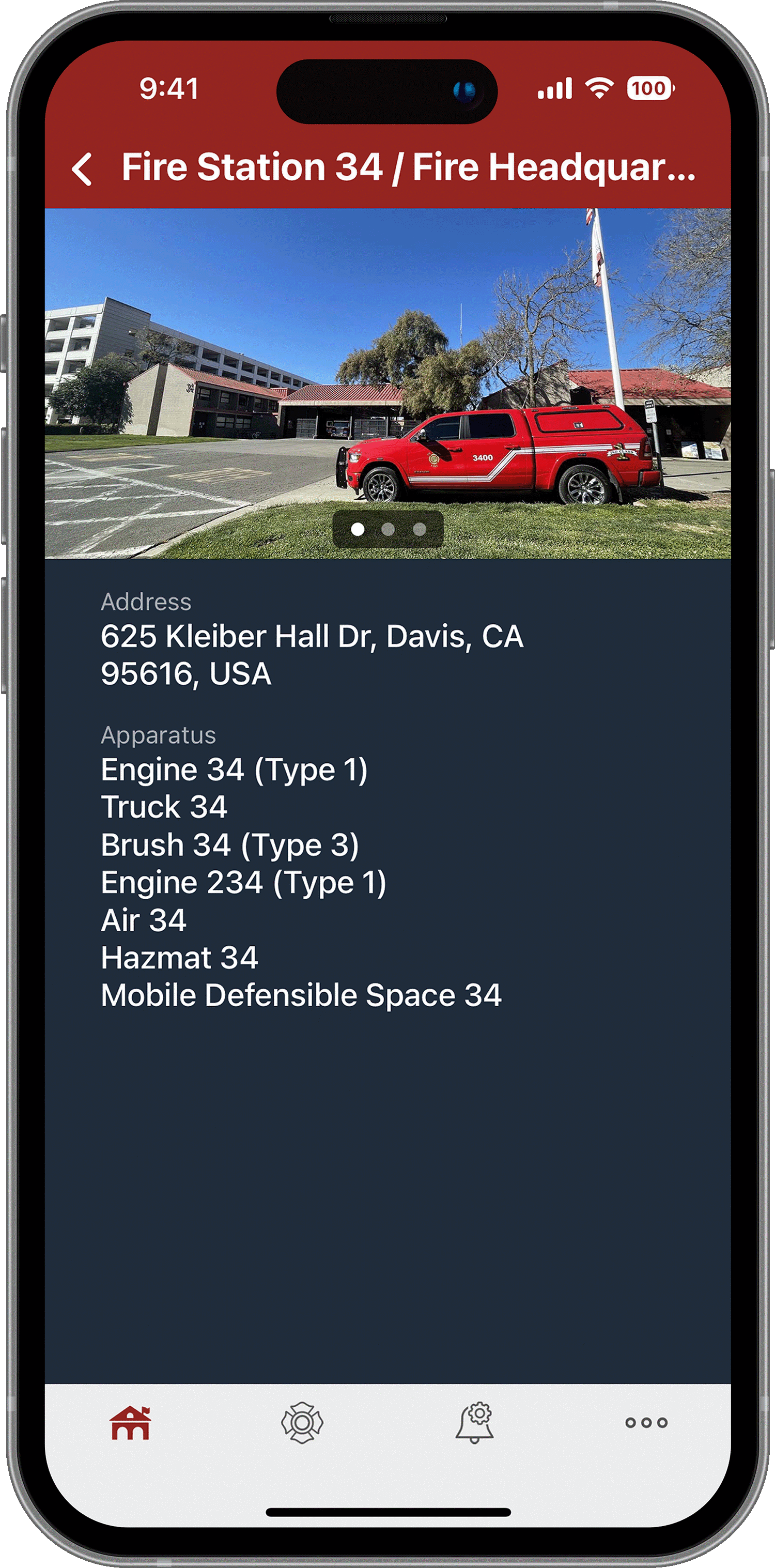
Tapping a station icon displays the agency-provided facility details such as name, address, assigned apparatus, and images.


